This Month's Story

Years ago, when I worked in Washington DC, my officemate used part of his time to work on his PhD thesis. Although the time he spent on this as opposed to his normal work seemed abnormally long to me, I didn’t say anything since his work had nothing to do with mine.
John was a modeler. And his thesis had to do with modeling the flow of water around a square island. In his model, he would change the speed of flow and its direction toward the island and from this he would get a certain amount of results. When he exhausted these sets, he would make the island into a rectangle rather than a square and repeat the process. All of these changes took time and he would spend hours examining the results.
As I said I really didn’t care, but I found the whole thing absurd. Where would one find a square island? One day I found a manuscript dealing with much the same thing but the island in the manuscript was round rather than square! I found the author’s results fascinating and mentioned it to John. John read the work and then gave it back to me saying the results really didn’t apply to his work.
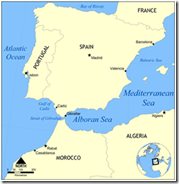
I shrugged and I returned to my study which at the time was the flow into and out of the Mediterranean via the Strait Gibraltar. At the start of my work, I used infrared satellite imagery for the surface flow and scientific ship’s deep water data for the subsurface flow. The data I used were scattered in time and space, but they did give me enough information to support a working hypothesis for a field study that I did several years later.
Well, John got his PhD and went to work with the Corp of Engineers. I went to work at a US naval research laboratory in Mississippi where I continued and finally initiated actual field work about the flow through the Strait of Gibraltar. I have no idea how the Corp used John’s square island study but the field work I did on the Strait was a success and made my name as an oceanographer.
In fact, the Strait work led to my eventually leading a multi-nation study of the circulation of the entire Western Mediterranean Sea. It was a large study that utilized multi-instrument data collection platforms and a rather long period of study; five years to be exact. I began spending fifty percent of my time in scientific laboratories surrounding the Western Mediterranean Sea. One period that I really enjoyed was the period I spent as a visiting scientist at Universitat de les Illes Balears on the island of Mallorca, off the coast of Spain.
Because of its nearness to the various other co-investigators, it was a perfect place to act as chief scientist. The university and government laboratories working with me on the study went very well together and I spent most of my time visiting with their cooperative scientists going over their results.
One day I received a call from a Spanish colleague who asked me if I would present a lecture at his university the following week. His university, he said, would arrange all of my travel details and expenses. I really didn’t know where his University was as I had only met him at Spanish scientific meetings near Barcelona or Madrid. Since my calendar the following week was clear I said yes to be polite and thought no more about it.
The next day, the departmental secretary came in and placed airplane travel tickets, a voucher for travel expenses, as well as details of the date, time, and subject matter of my lecture on my desk. She gave me this on Tuesday morning and told me that my lecture was scheduled for the Thursday of the following week.
I had a large office which I shared with another Spanish colleague who was also involved in my Mediterranean study. We needed the large space to look at the bulky data the other experimenters sent us. After the secretary left, he came over and stared at the tickets perched on the edge of my desk.
It was only after he had read the whole package and he spoke up that I began to realize that my trip was a little unusual.
“Are you really going to give a talk at the Universidad del Palmas?”
“Yes. Why not? Why do you ask?”
“No real reason. I have never been to the Canneries. Can you arrange for me to go with you? I will carry your bags, even the big ones.”
I shot up in my seat and took a good look at the airplane tickets.
I was completely startled. They were for me to go to the capital of a small group of Spanish islands in the Atlantic Ocean; a group of islands along the western coast of Africa near Morocco. A faxed folder had accompanied the material placed on my desk. I grabbed it and found out that I was scheduled to give a one hour lecture on at the university on the morning of the following Thursday. Its topic was to be Satellite Oceanography. What was even more surprising was that the description of the lecture gave no mention of the reason I was at the moment staying in Spain or that I had anything to do with a multi-national experiment on the circulation of the Western Mediterranean Sea.
My colleague went to the map case we shared, and producing a large map of Spain, laid it on our work table. I was flabbergasted at the distance I was to fly in order to even get to the Canaries. While I was looking at the map I did noticed one thing. The island of Gran Canaria where I was to give my talk was round and I had seen it before!!
Given the subject of my talk and the time between the invitation and the talk, I began to feel that as I was a specialist in satellite oceanography, I might be able to get something different out of my lecture than I had thought. During my time in Washington I had worked for two years as a Fellow at the NASA Goddard Research Center working on satellite ocean studies.
Here’s where the coincidence came in. During this period I had become fascinated with a group of Atlantic islands that had a round island in its southern center. Most importantly, that island shed drops of water that varied in color and temperature that markedly differed from the surrounding Atlantic Ocean water.
When I say shed, I mean just that. Water of a certain character flowed south from the island much like a dripping faucet. Initially the water slowly accumulated on the southern side of the island until it reached a maximum size, then it would drop off and become a large droplet in a train of droplets that flowed to the south where after about 300 miles the droplet would slowly become assimilated with the surrounding water and disappear.
That island was where the University del Palmas was and where I was being invited to lecture!
I quickly wrote a fax to Becky, the branch secretary in my office in Mississippi, to contact my old friends at NASA Goddard to get copies of my old papers and send it to me by overnight mail.
It worked. When I boarded the plane for my long journey the following Wednesday I had a nice packet of pictures to present as part of my talk.
But wait there is more to the story than the fact I had pretty pictures to show of the Canary Islands from space! As the plane flew along Algiers on the northern coast of Africa, I realized we would be flying directly over the Strait of Gibraltar.
I quickly rummaged through my brief case till I found a color shuttle picture of the Strait that showed internal waves pouring out of its eastern end. It was an impressive picture that showed phenomena that could only be seen with the naked eye at certain times of the month. But they could always be seen with ordinary radar. I knew this as I had done this many times.
I rang for the stewardess and asked her to show the picture to the pilot. Maybe this time would be one of the rare times the waves could be seen visually. She took it and hurried forward to the pilot’s cabin. Soon she came back and told me that the pilot wanted me to come forward to the pilot’s cabin.
When I went forward, I was amazed at its resemblance of the pilot’s space to the small navy P-3 cockpits I used for my work. There were three chairs, the Chief Pilot on the left, the engineer in a high seat in the middle and the co-pilot on the right. In fact, when I looked to the floor to the right of the pilot’s seat I saw the aircraft’s radar controls with a small repeater screen.
The Chief Pilot was a little stuffy but he seemed extremely interested in the Shuttle photo I had sent him. I explained about internal waves and what ocean phenomena the photo showed. I explained that what he had was a photograph taken from space by an astronaut. I also told him that the waves in the photograph were only that well pictured at the maximum high tide of the month.
I didn’t know where we were as far as this month’s tide was concerned, so I didn’t know what we would see at the present time. The engineer was a fisherman and said that at present, it was about three days before the new moon.
As we passed over the Strait however, we found the region was completely covered by clouds. We would have to rely on the plane’s radar to show the waves. I got on my knees and with the pilots permission started to adjust radar to allow for maximum “sea clutter”, that is the sea surface roughness conditions.
Instantly, the screen showed the sea conditions and the v-shaped wakes of the large quantity of ships passing through the Strait. I fiddled with controls, then as luck would have it, faint arcs from old internal waves also began to show themselves in the sea surface return. They were very faint, but they were there.
The pilot was amazed,
“You say they are only a foot or so high?”
“Their surface expression is very small, but they extend down several hundred meters. I was in Rota when a Russian submarine was caught on the up rise of one of those waves and it crashed into the stern of a Russian trawler they were hiding under. I image the Russian captain is assigned to guarding a dog house in Siberia today.”
By now I felt the plane start a change of direction. We were well beyond the Strait and were turning to the south along the western Moroccan coast toward the Canaries.
I returned the radar to its normal setting and stood up and prepared to return to my passenger seat. I looked at the pilot who was staring intently at the shuttle photograph. I felt it was a long shot, but prepared myself to ask the pilot a favor, which was the real reason for my giving him the photograph.
“How long before we start our descent to Gran Canaria?”
“Maybe ten minutes; very soon. If you like you can stay up here and tell us if we are doing something wrong.”
There was a small emergency seat directly behind the chief pilot and I pulled it down and made myself comfortable. Once settled, I spoke up.
“Gran Canaria has a surface feature a little bit like the Strait of Gibraltar. On the southern end, water accumulates like the drip at one end of a spigot. You can see it from space. I’m sorry I did not bring one of those pictures with me to show you; it’s quite amazing.”
The Chief Pilot looked at me, his mouth half open. Then as if on cue, the co-pilot spoke up and gave my remark an added boost.
“It’s true. I have a small plane I fly around the island many times for fun and I have seen the feature he’s talking about several times. It is very impressive”
It was quiet in the cabin; the unspoken question hanging in the air.
The Chief Pilot seemed to grit his teeth for a moment and finally spoke loudly in a stern voice “This is a commercial aircraft owned by the government of Spain and we do not go around looking at every pretty thing that catches our fancy!!”
It became extremely quiet in the cabin.
Then the Gran Canaria control tower started giving us our approach instructions.
The chief pilot reached up and took down his microphone.
“Gran we are having a little problem with our (after all these years, I cannot really remember what that problem was supposed to have been. But evidently the flight control tower knew what it was and gave us instructions to proceed at our discretion). We will fly once around the Island to make sure we have the problem solved and then come back to you for landing instructions.”
When we reached the southern side of the island we found the water was three quarters cloud covered, before this however, there was a definite line in the water that led from the island’s southeastern edge to the cloudbank. The line was one segment of my round island drip!
We continued around the island and landed. The chief pilot stood at the cabin door and greeted the departing passengers. When the last passenger left the plane, the crew began their departure. As I walked down the landing platform, the chief pilot gave me his thanks for showing him the two ocean phenomena and behind him the co-pilot also gave his thanks, as well as a smile and a very definite wink.